Warning: LONG
Also, I used a repetitive title to get hits under different search results. We had better luck finding helpful information by searching Condor Trek versus Ruta del Condor.
This one will be hard.
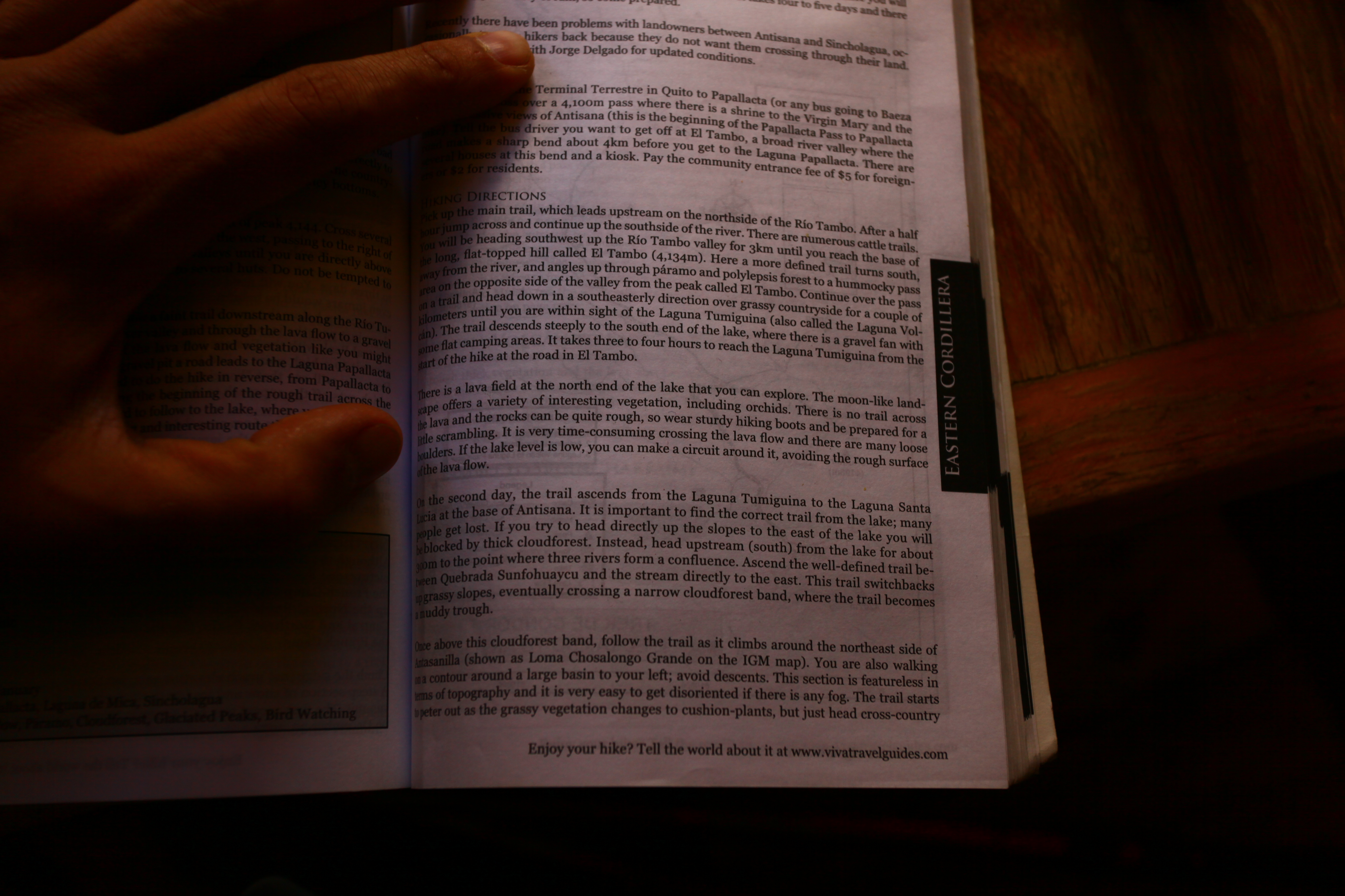
When we found out Sam was coming, we decided we would hike the Ruta del Condor (Trek of the Condor) to the base of Cotopaxi, take a day or so of rest, meet a guide company, and then attempt to summit the beast. After reading a couple of post online and finding them rather unhelpful, we decided to consult a couple books to find the source info and make our own plan. We consulted the books “Trekking and Hiking in Ecuador” and “Andes Trekking,” usually available to look at in hostels, to find out which maps we needed as well as get a better idea of how the trail was going to go. We found “Trekking and Hiking in Ecuador” to be much more helpful which instructed us to get three maps, the IGM (Instituto Geografico Militar) 1:50000 series of Papallacta, Laguna Mica, and Sinchulagua. We also bought Cotopaxi but didn’t need it as our final camp was on the North side of Coto, which is featured on the Sinchulagua map. Anyways. at night Sam and I started combing through the literature to find the route and dot it along our maps only to find out that I had forgotten to get the Papallacta (read the whole first two days) map, so we mapped out what we could on the last couple of maps and I decided to wake up early, head back to IGM to get the final map, return to the hostel, figure out the rest of the route, and hit the road as early as possible.
 Among of all this, we figured food rations, made lunch wraps, trail mix, left unnecessary stuff at the hostel to get when we returned, and checked out. We had also met with Paul at CarpeDM tours below The Secret Garden hostel in Quito and arranged guides through Condor Trekking to meet us in the Cotopaxi National Park after our trek plus a rest day. Paul was incredibly helpful and drove us around Quito to the guide shop to get outfitted for clothes as well as taking us to various ATMs to actually pay for his services.
Ok, so to recap, we finally had all of our maps with ideal routes and alternatives, food/fuel was rationed, bags were packed, things were being held at the hostel, and guides had been arranged to meet us in the park with fitted expedition gear afterwards.
By the time we check out of the hostel and get to the Quitumbre bus terminal, its 11 o’clock with a 2 hour bus ride to Papallacta. The bus leaves at 12 which should put us on the trail at 2, with a 4 hour hike puts us as at camp by 6 and sundown by 7. No problem. But that would be too easy, wouldnt it. This bus, for whatever reason, could not go faster than 30 MPH and it took us 2 hours to even break into a town 30 minutes way. At one point, he pulled into a gas station and we thought he was going slow because he was low, but this was not the case. He pulled out of the gas station at the same snails pace and I think we all about had simultaneous aneurisms. When we had finally had enough, we bailed on the bus, told him he was going offensively slow, and loaded into a taxi for the last leg of the trip, which at this point was still another 1.5 hours. After getting in the cab, we immediately hit city traffic and basically played leap frog with the bus we just got off. When we got out of the city, we left the bus in the dust and were finally running free into the hills. The cab dropped us off at a big sign that read “Ruta del Condor” about 4 km before Papallacta where a nice lady came to whom we paid our 5 dollar community fee. Don’t get too comfortable, gang! The community fee was expected, but she told us usually they give receipts but she didnt have any so to tell the guard a little further up the hill that there were no receipts and that we paid. Naturally, when we get to the guard house, he askes for the papers, which we didn’t have, and says we can’t enter without them. I then tell him that I was told he would say that but the lady didn’t have any. So after the unhelpful guard told us off and to have a good trip (I about lost it here) we went back down the trail to chase down the lady who had taken our money. Fortunately we found her, explained the situation, and got our money back. She turned out to be very nice about the whole thing, and I think I love her because of that. She could have been very difficult. With money in hand, we march back to the guard house to pay the guard, only to have him say “Oh no no you can’t pay me you have to pay the community fee down below.” We all about lost it. I had to then again explain how we had already paid and there were no receipts to be had, he was unwilling to accompany us to oversee any transactions, and was overall incredibly unhelpful. Finally, I say, “Help Us.” With a grin common to those intoxicated by the scant amount of power they hold, he asked what he could possibly do, and I told him to write us a letter saying that we paid and that we could go freely. To our surprise but with seemingly great effort on his part, he actually wrote us a note (I got Sam to take pictures of the whole process incase we met flack anywhere), took our money, and let us go. As you will find out, there are plenty of reasons NOT to do this trek, but I will here advocate avoiding this trek because if this one guards behavior and the inefficiency of the system in general. It is very clear that there is a disconnect between the locals and the parks service which has contributed to sour relations between the two. Again, unless you are willing to put up with a social and systemic mess, avoid this trek, or hire a guide company. Finally, after a slow bus, massive traffic, an asshole guard, and a sweet local woman, it starts to drizzle and we hit an unmarked trail at 4pm.  Needless to say, things were really shaping up.
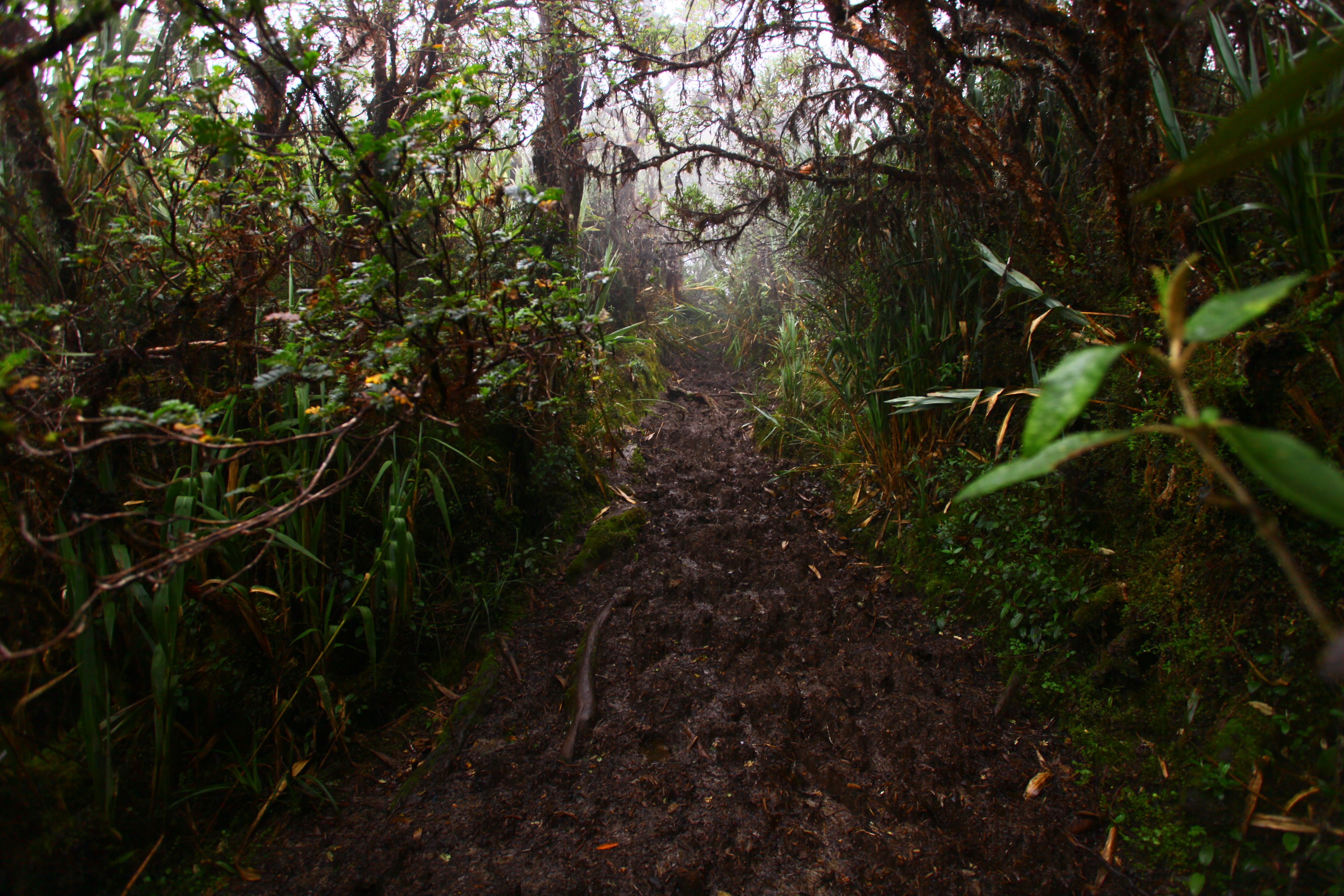
Ah the Ruta del Condor. With its non existent trails, lack of suitable camping, and knee deep mud, who could ignore its charms. Between Sam and I, we have over 3 months of navigation intensive training via NOLS in both the Pacific Northwest and the Wind River range in Wyoming. Sam, probably more versed than I in the ways of analog navigation, described it as a “micro-navigational hell.” This is true for a number of reasons, most notably the lack of trail which leads to really slow going and constant trail finding . When recounting our tale to our guides when we finally arrived at Cotopaxi NP, he told us that 10 years ago, the Ruta del Condor was very popular and everyone was doing the trek. Then at some point there was a problem between the locals and the park services and people stopped doing the trek, leaving the trail unattended to become overgrown and largely indescernable. So here we are, 2 hours late at the start, walking through farm land at first, then waist high clump grass (that eventually dewed as the temp dropped) all the while micronavigating river crossings, sprawling mud fields covered with dense moss (so you thought you were stepping on something solid until it gave way) in the clouds so you could hardly pick out navigable features with maps that were contoured at 40 meter intervals. 40 Meters! That means that if you had a hill in front of you 120 feet high, you would not see it on the map. On the map it would just look flat. Fortunately, after plenty of slow going, lost shoes in the mud, being totally wet from water creep, etc, etc, we set eyes on the lake where we would camp. On the map, from this point it looks like a gradual downhill to the camp spot, in reality, it was a hellacious nightmare of clumsy high grass, mud, and rolling hills. As happens every day, the sun eventually dropped below the surrounding mountains, then the horizon, and left we three fumbling around, looking for alternative camps under headlamp light. Now imagine this; you are in a field of waist high clump grass (read no flat camping spots), soaked with mud water and cold, with a rough direction of travel, exhausted from constantly fighting mud and working doubly hard to “unwalk” your feet out of mud, at night with your primary camp spot at least another hour away. Desparate indeed. Somehow, and this is probably the biggest miracle of the whole debacle, we happened upon a roughly level spot and decide quickly to call it and set up camp. This was no glorious camp site either. It was partially inundated, I was sleeping on what could be described as “lumbar support” but in reality was a “small mountain,” but it was still usable. We fit our two small tents into an even smaller spot, had a quick dinner, and did our best to sleep to get ready for day two.


On the morning of day two, we woke up to a pretty heavy fog and wet clothes. We had a quick bite to eat but saved making our hot breakfast until we hit the originally planned camp. Soon after orienting and packing up, we set out on the nonexistent trail and had soon laid eyes on the lake. Which part of the lake was uncertain but it was there and reasonably close. As we closed in on the lake, we realized how lucky we had been to find camp the night before. About a kilometer from the lake we found ourselves at a steep, muddy hill down to the waters edge, naturally with no workable trail. It took us about an hour to navigate down to the waters edge and around to the original camp spot. It was reasonably risky during the day and would have been impossible at night. So we finally get to the “beach” and make food. Holly was optimistic and gave her shoes a good cleaning.
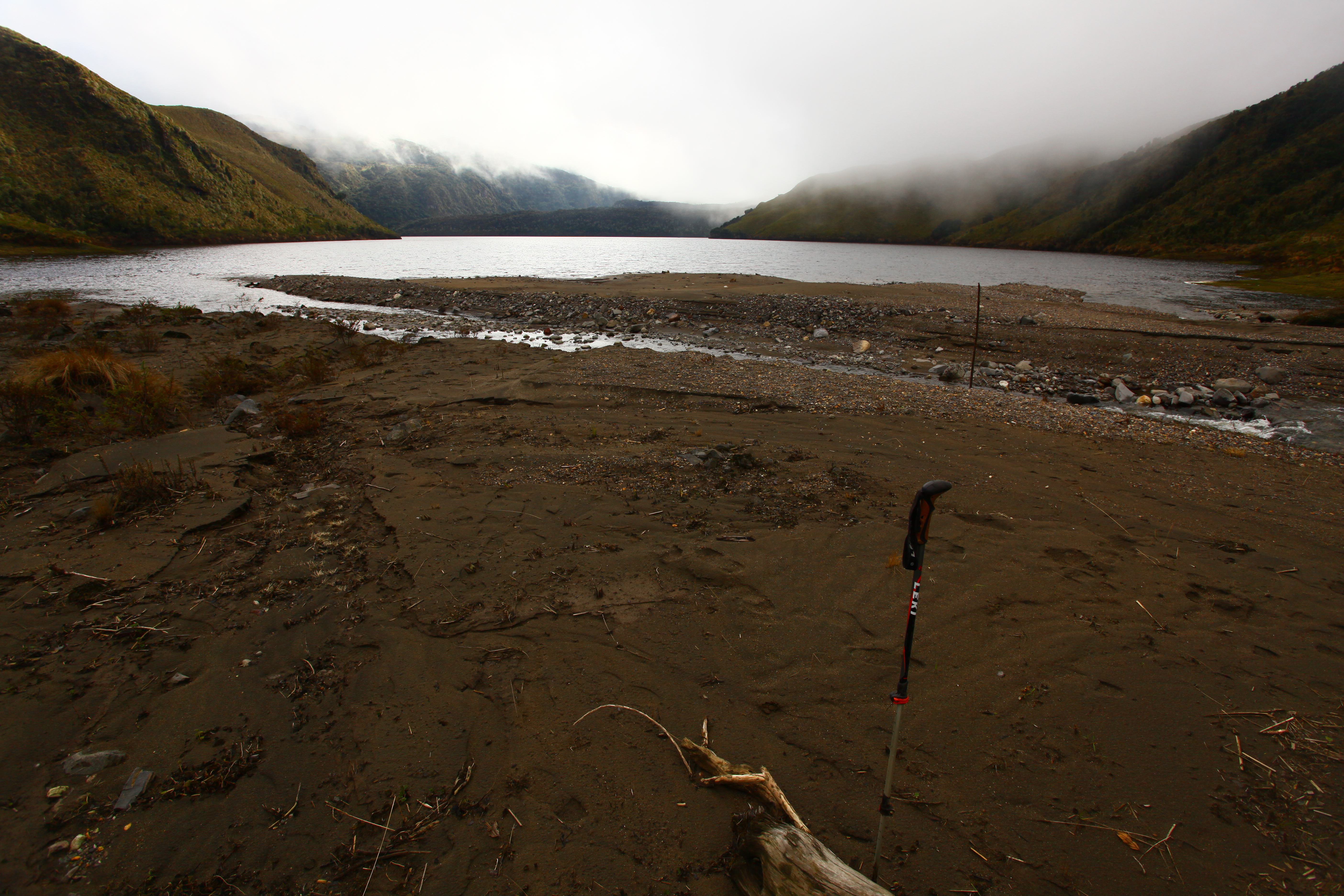
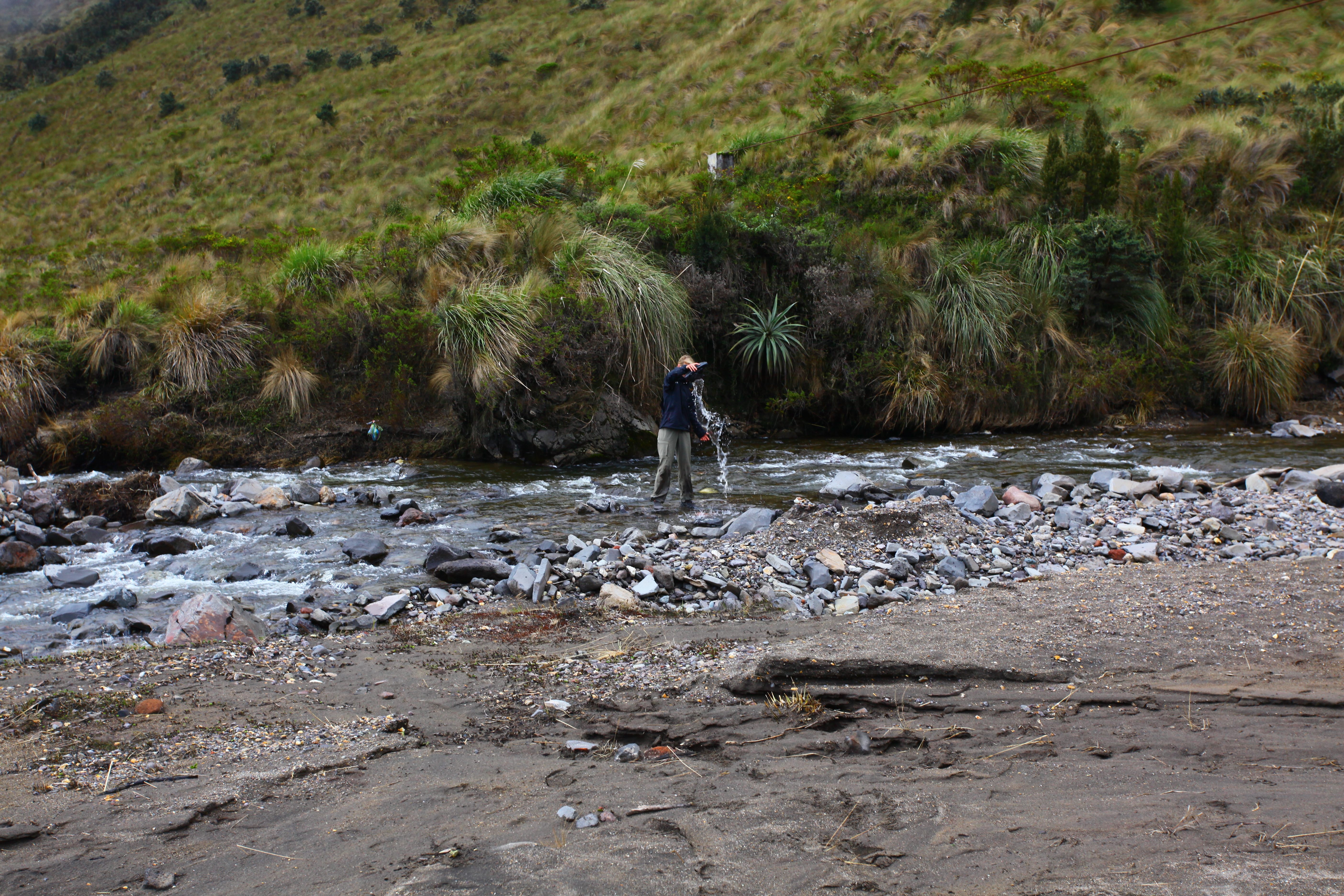 We loaded up on water and cleaned it, and after all is said and done we are back on the move by 10AM. We headed up the valley as described by the guide book to only find a convergence of two rivers, not three, but head up the hills anyway. At this point we have realized how rough the directions are so we are not totally thrown by the lack of an entire river. After trying several options and dead ending, doubling back, starting again, etc, we finally settle on a direction, all the while following a “trail” which was usually decided by either Sam or I saying “This looks kind of impacted here.” For this day’s hike, the book says of one particular section to “Avoid descent” which became the mantra for the day regardless of location. If there was ever a choice in up or down, it was always “AVOID DESCENT!” and up we went. This actually turned out to be a pretty good method, and although just as miserable and mud covered at the first day, we had all of this daylight to deal with, so we progressed slowly but with slightly higher spirits knowing that we would be arriving at camp with the sun still up.
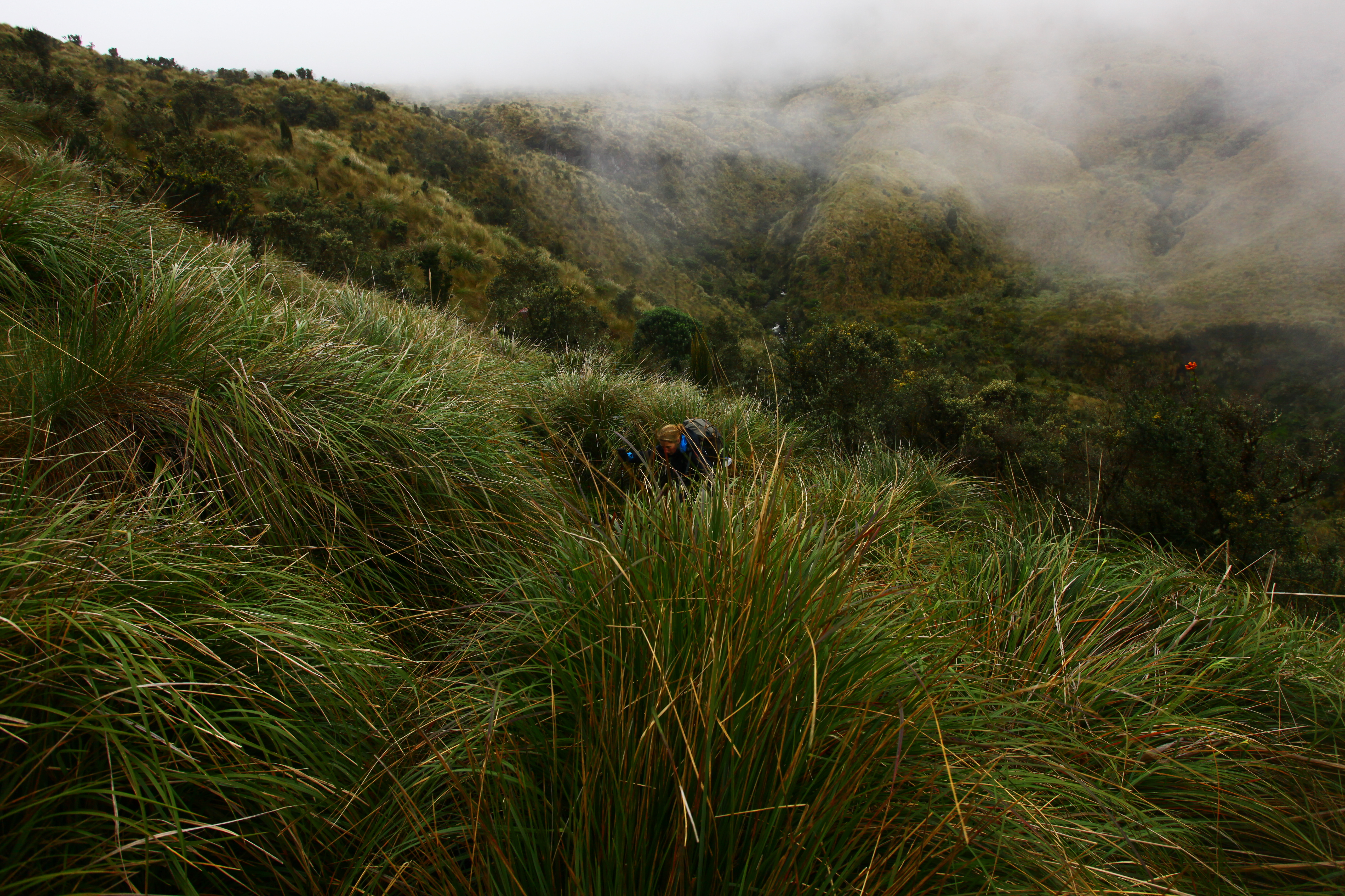
 Eventually, after many high roads, confused trails, digging out boots, wet feet, short breaks, fog, mist, and sore feet, we set eyes on the first proper land mark, Volcan Antisana. If you hike like we do, which is to say in lots of terrible weather, you will understand the psycological significance of getting visuals on something like Antisana. A true spirit lifter.
  We marched along, constantly micronavigating for efficency, avoiding sink holes, etc all the while staring up hoping for the low clouds to clear up enough again to set eyes on Antisana. After plenty of stumbling of clumsy grass lands, we met up with the faint jeep track we were promised and followed it as described into camp on a lake at the NW side of Antisana. With relatively high sprits and the promise of easier hiking the next day, we all washed the mud out of our shoes and settled in for a little R&R. I set up our new flat tarp as a cook/hang out shelter and we made plenty of hot drinks and ate a decent dinner. As we went to bed, the skies really cleared up.


Holly commented that it had been a long time since she had seen skies that clear and stars that bright. I had to agree. The Milky Way was clearly visible as a bright band of stars across the sky and enough twinkling dots to boggle the mind. 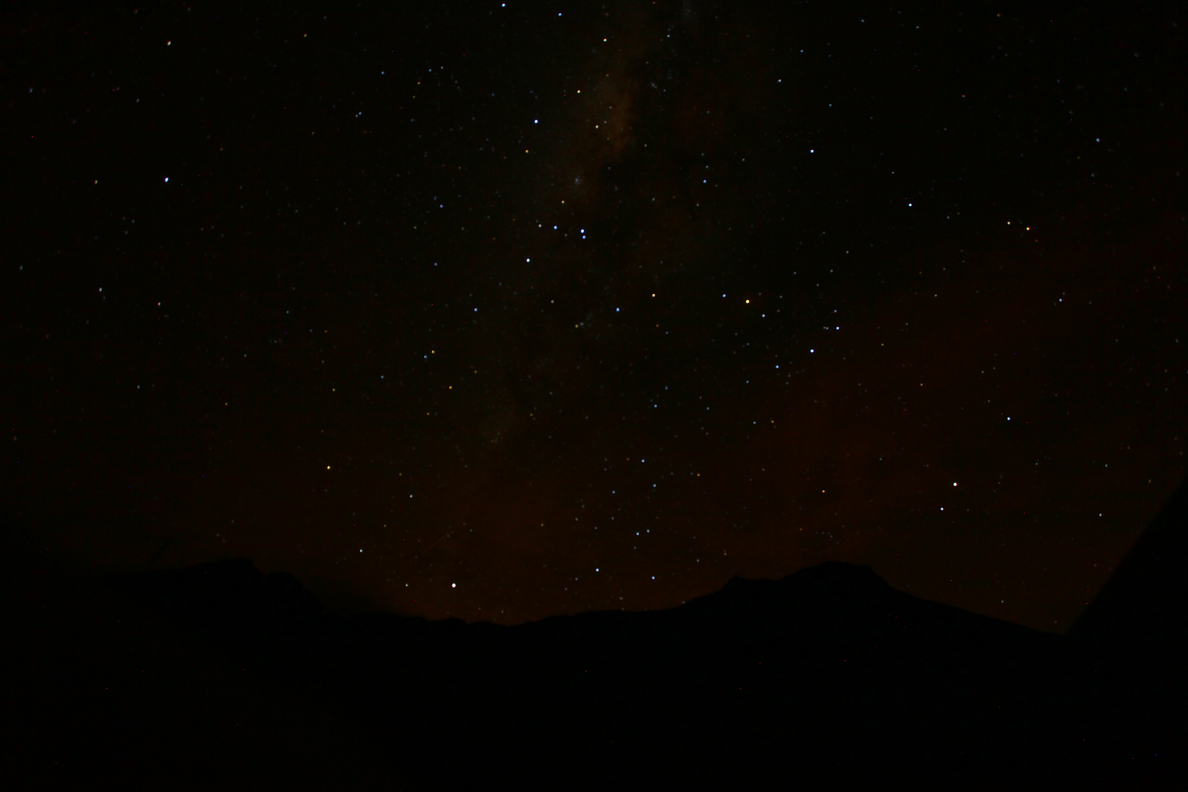 But this is a funny thing about dry season. In the wet season, there is a lot of rain, cooler during the days, but cloud cover at night. This cloud cover actually traps heat and leads to warmer nights. In the dry season, the lack of night clouds leads to great stars, but can make it bitterly cold. Especially at a high altitude lakeside camp at the base of a galciated volcano. Needless to say everything froze, hard. Our tent, which is a glorified trash bag, was like concrete. My sleeping bag would stick to it like Harry’s tongue to a chair lift. The shoes and boots that we so generously washed the day before turned into ice blocks. The ground had frozen solid, and at some point in the morning a snow started blowing in from around Antisana. Also, and here is the real kicker, since we had set up a kitchen tent, we left our food out. This was a devastating decision. No where in our literature had we come across mention of nosy high altitude foxes. Well it turns out our 36 meat and cheese wraps, our main source of lunch protein, are foxes’ favorites. I woke Sam up saying, “We’ve been robbed,” and of the 36 that bastard fox got away with well over 25. With the situation desperate, none of us really enjoying the adventure, frozen shoes and all, we decided to make “sock soup,” thaw out as best we could, and see where the jeep track put us.


Various factors lead us to make our next major decision. On top of greatly depleted food stores, low spirits, and a late start for our longest day, my (Brent) frozen shoes progressed sore feet to painful blisters pretty quickly, and after 3 hours on an actual road we found ourselves along a well traveled access road with a gate house. We asked the guards which way to our next spot, asked how long he thought it would take (another 7ish hours) and pointed us in a different direction from our original route. Descision time. The day in front of us involved skirting around a minor mountain, up one valley, jumping out of the valley at some point and crossing into another and up to the headwall of the second. Sam and I were both exhausted by the constant micronav and I at least was starting to dread the day ahead for both my feet and my brain. At one point, we sat along the side of the road and had a think. We all wanted to continue but I think it was more out of pride than enjoyment. Holly and I were both rabid to continue in one sense because we had been defeated in these instances so many times before: Cotacachi, Pichincha, Imbabura (twice!), most of Peru, etc. We felt like this one owed us something, god damnit. But ultimately, Sam put it into perspective and said that Cotopaxi was the real goal and it wasn’t worth it to beat ourselves up on the journey. We called it right there on the side of the road, and with hung heads walked back to the guard stand, met a truck, and got a ride into Pintag. 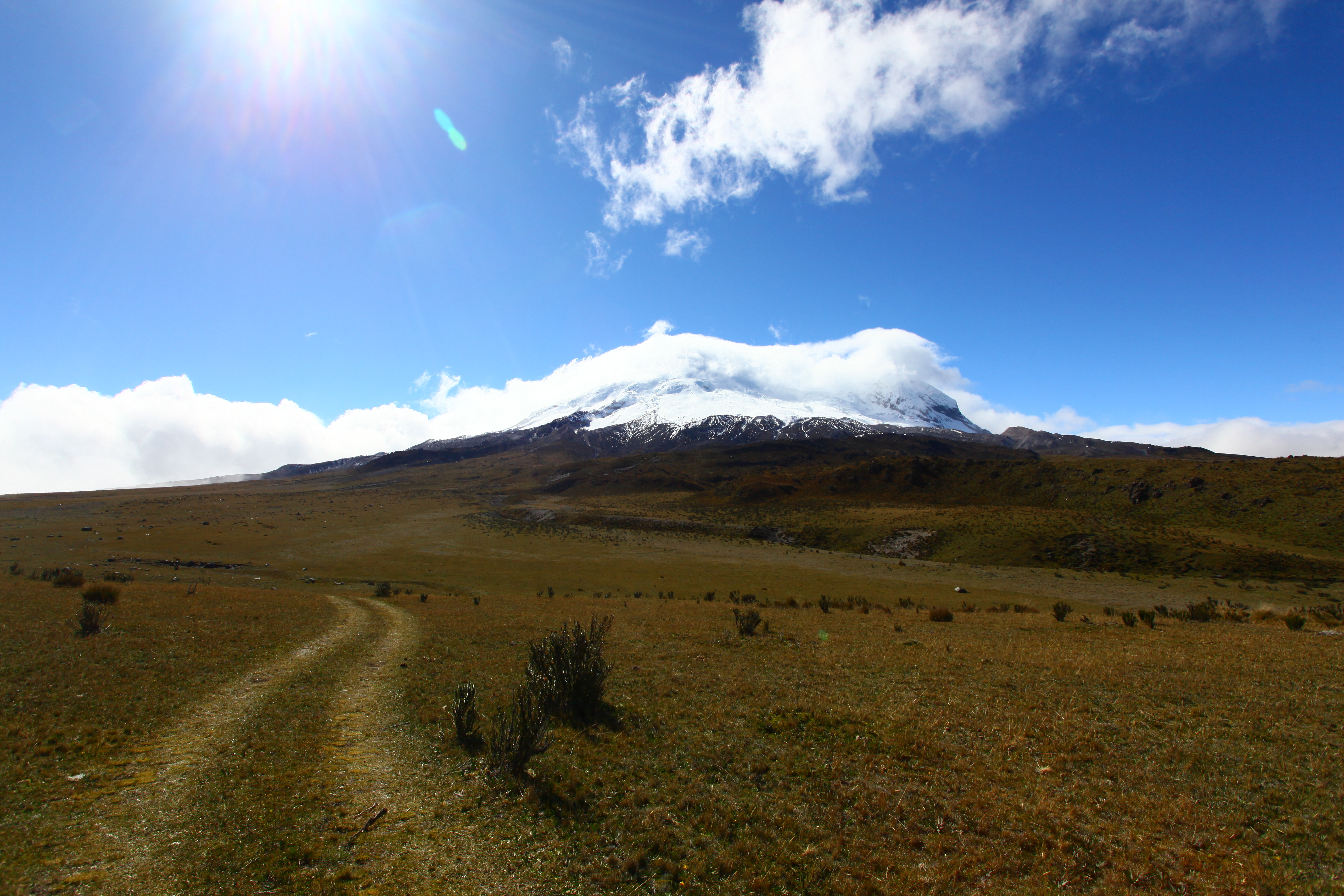 We got the driver to drop us off at the one hostel in Pintag and were greeted with three beds, Three Ninjas (2 and 3), and some interesting room accoutrement, including an ash tray and a condom. The ash tray I get, but the condom? It was a room with a double and bunk beds. Different strokes for different folks, I guess. I quickly took my shoes off and tried to get a hot shower but was disappointed there. Luke at best. We laid out our soaking shoes, hung up our tents in the room to air out, and generally sprawled. We eventually worked up the energy to walk into town for a late lunch, picked up some beers and a box of wine, and went back to the hostel to lick our wounds. The rest of the night was an exercise in indulgence. We ate the food we had planned and then some, knowing that tomorrow we would take a truck into the park and that we would have to reration anyway for the lost wraps. When we woke up, we tromped around Pintag looking for breakfast, didn’t find any, but eventually found a lady setting up her pork stand. We each had a glorious pork plate for breakfast. Oh my god it was good and Sam’s first. What an introduction. We later went to the store, loaded up on tuna, more coffee and hot chocolate, and some other campy goods. We went back to the hostel, packed up shop, and hit the road again, looking for a ride into Cotopaxi NP to Laguna Limpiopungo. This turned out to be a little trickier than expected as no one on the Pintag side of the range was familiar with the other. After probably an hour of trying to find someone who knew the place, we found a driver who still didn’t know it, but decided he wanted an “adventura” and then we were off. One of the maps I had showed a couple of possible paths to take to the lake. Our driver clearly had no idea how maps work and went against my recommendations on a number of occasions, asking for directions and relying on those given in a place where people will make something up rather than say they don’t know. This, again, was not much of a problem because we had a good headstart on the day, had already agreed on a price, and it was his time we were wasting, not so much ours. What should have been a 2ish hour ride along major roads turned into a 4ish hour ride along deeply rutted dirt tracks, but again, no sweat and it actually turned out to be a real highlight.
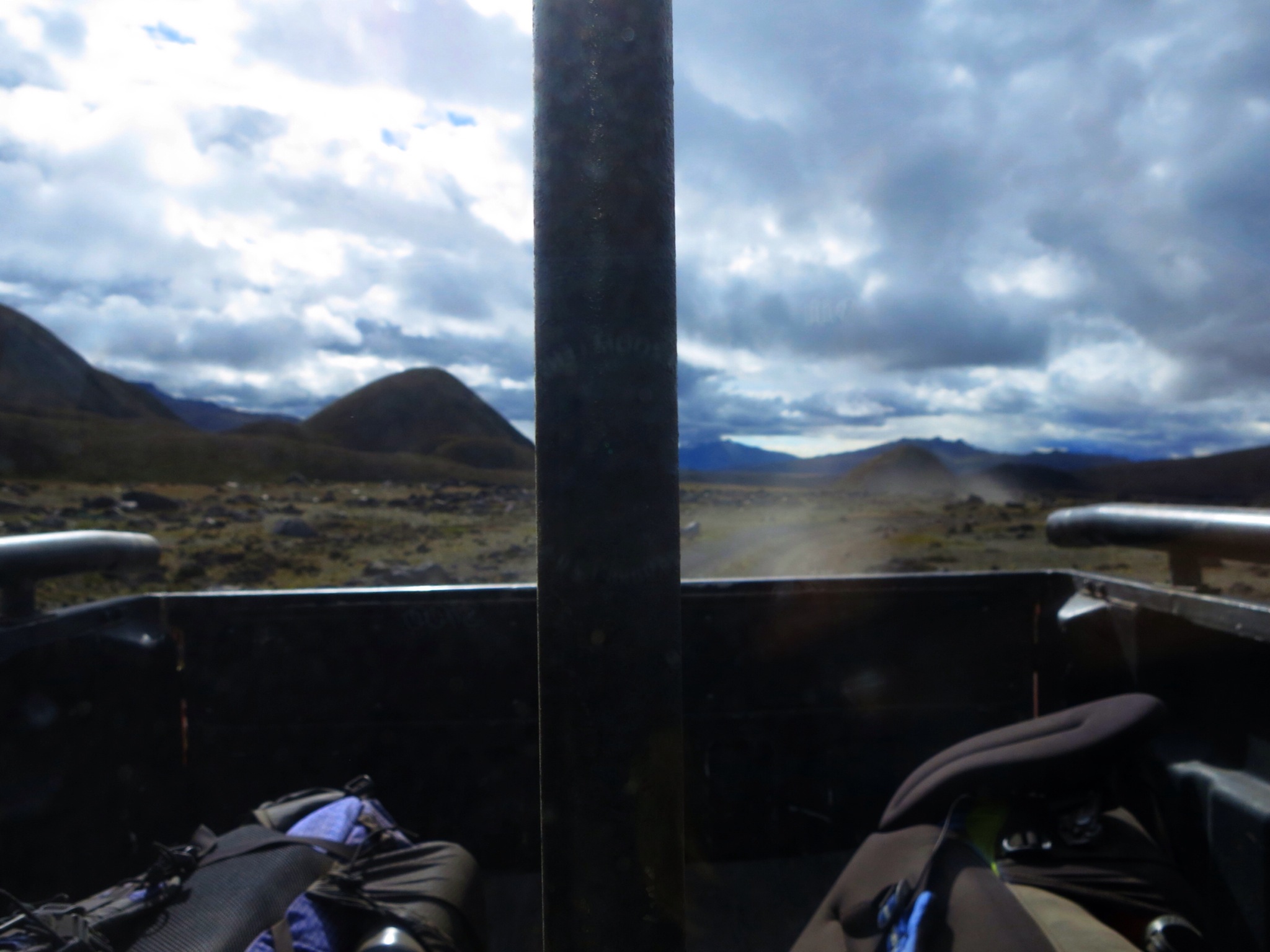 There were, however, a couple of times where the road seemed to give out and the driver would say, “this is the end.” I would then show him there was indeed more to go and we would eventually pick it back up and continue. We carried on this way through lava flows, private farm lands, dealt with bulls, crossed rickety bridges, dead ended and back tracked, through crazy hill formations (Las Piedras Blancas) and finally the driver gave up. We eventually met up to a more major road and the driver filled us in that he had to be somewhere at 5pm, but we were in such a cool spot and the weather was nice we let him leave and we finished the route on foot.
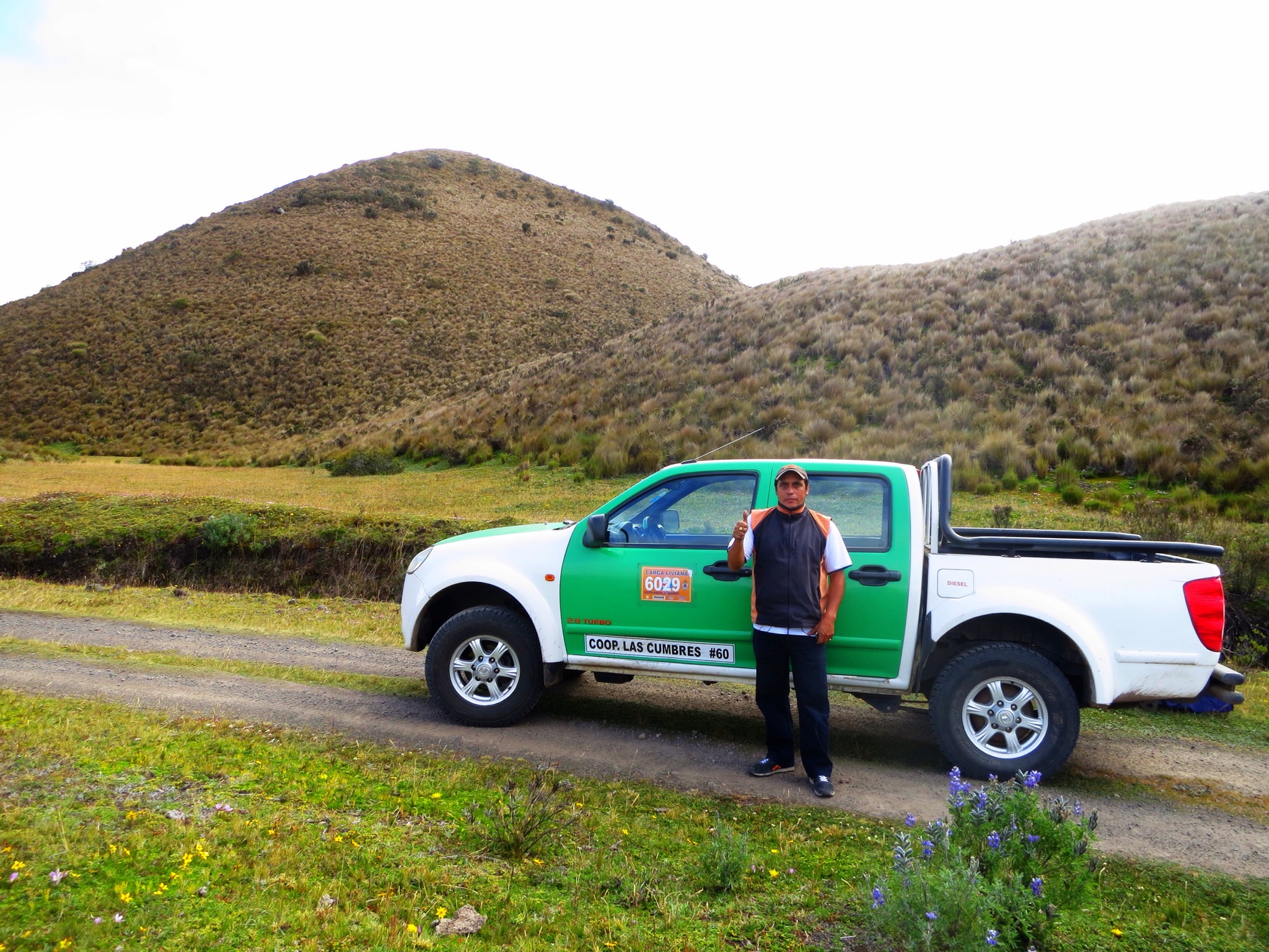 As it turns out, he dropped us off roughly where our camp for that night was supposed to be, but instead of camping we kept walking to get different views of the landscape, and eventually laid eyes on our second major landmark, Cotopaxi itself.
 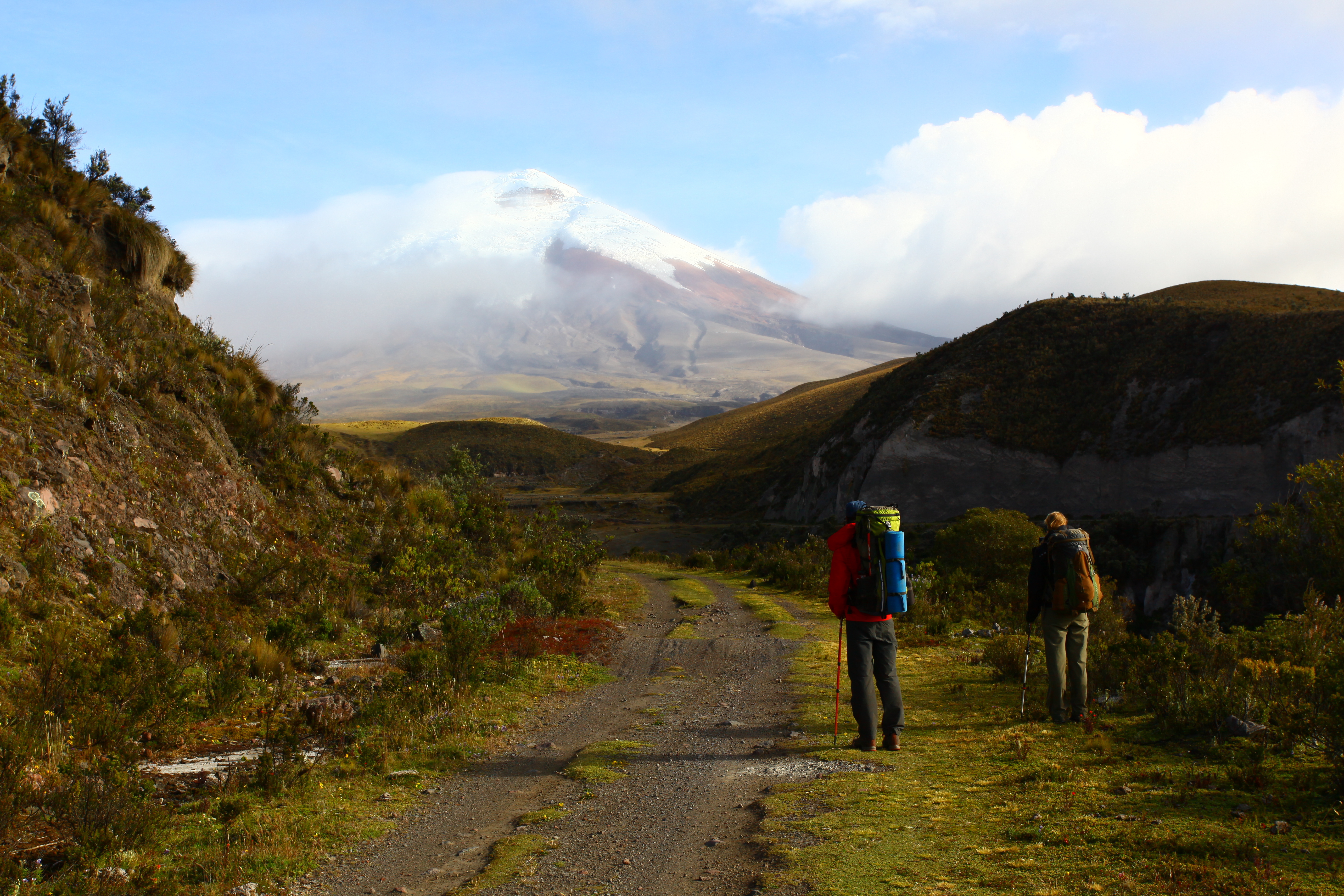 It was sunny, but the weird high altitude weather carried in mist on a wind from the volcano and made constant rainbows. With sights on Cotopaxi and a decent idea of camp, we kept walking until it started to get dark, set up a pirate camp (we didn’t quite make it to the actual spot) in the shadow of the volcano, and had dinner. We stayed out for a while that night regardless of the cold and enjoyed the stars and the faint outline of the volcano. We drank wine we had brought along and marinated on the task in front of us. It was easy to feel small next to that perfectly shaped monster, but in the end it left us excited for the coming days. I think we all slept well that night.


We woke up to a pretty normal morning. The lower altitude meant no crazy cold nights, but there was plenty of wind and fog, so we had breakfast, packed up camp and made for the actual camp spot, Laguna Limiopungo. When we actually got to the lake, however, there was a sign that said in no uncertain terms, “NO CAMPING.” Great. This is where we had agreed to meet the guide company, but no worries, we still had 2 days until they came to figure it out. Mind you it is still totally fogged in, and so from the lake we set out down a road until eventually we come across a massive camp grounds. This must be what they meant! So we find a good sheltered spot out of the majority of the wind, set up camp, start a fire in a fire pit, and get to work getting comfy. This would be a camp for the next day and a half. We spent our time hiking in the hills around camp, staring at the volcano and gathering wood for the fire.


All in all a good use of the time, until the day to meet the guides came. We had a note from the company saying they would come between 12:30 and 1:30pm and to meet at base camp. We had assumed, based on the usage this camp site had seen (major fire pits, lots of truck tracks, trash) that this was indeed the base camp. 1:30 rolls by. 2:30 rolls by. At one point we asked a CarpeDM truck (our booking company) where we are supposed to meet the guides and he points towards our camp but says they come later. 3:30 rolls by. 4:00. No guides. We are walking around, to the lake, around the campsite, trying to be visible for any passing cars. Eventually Holly walks back to the lake and runs into another guide. She told him we were trying to meet our guides and he asked for their names. We had no idea. He asked for the company and we said CarpeDM which is who we booked through but it was actually Condor Trekking doing the guiding. This we also didn’t know. Eventually she asks if there is another place where people go to do the trek and he says yes. Ahh another spot you say? So he offers to drive us there to check it out. We hopped in his truck and within 5 minutes were at another tiny camp spot, technically also close to the lake. While Holly was trying to call the company to find out what was going on, I took a more blunt approach and wandered around the camp spot asking strangers if they were our guides. We finally come across a guy and ask him about CarpeDM, which he knows, and he asks who we were. He then pulls out the outfitting sheet we filled out in the shop with our names. Our Man! We got in his truck, went back to our camp where we had left Sam, pick him up with our stuff, and headed back to the actual meeting place. We throw blame around for the confusion but eventually settle on it being the fault of “lack of communication.” Apparently the guide shop had given us the site location, the campsite “El Rincon” while Paul had told us the campsite by the lake. No campsites have labeled names, just “Campsite” so it was just generally poorly planned. Fortunately, since we met up late, we had two meals waiting for us, a bagged lunch and a hot dinner. We saved the lunch for after the hike (which I would recommend to anyone climbing Cotopaxi) and ate dinner like wolves. We checked out our fitted equipment again, hydrated like crazy, and watched the “sunset” on Cotopaxi. We went to bed that night around 7pm and tried to sleep. 10:30pm was approaching quickly and was holding back its own surprises.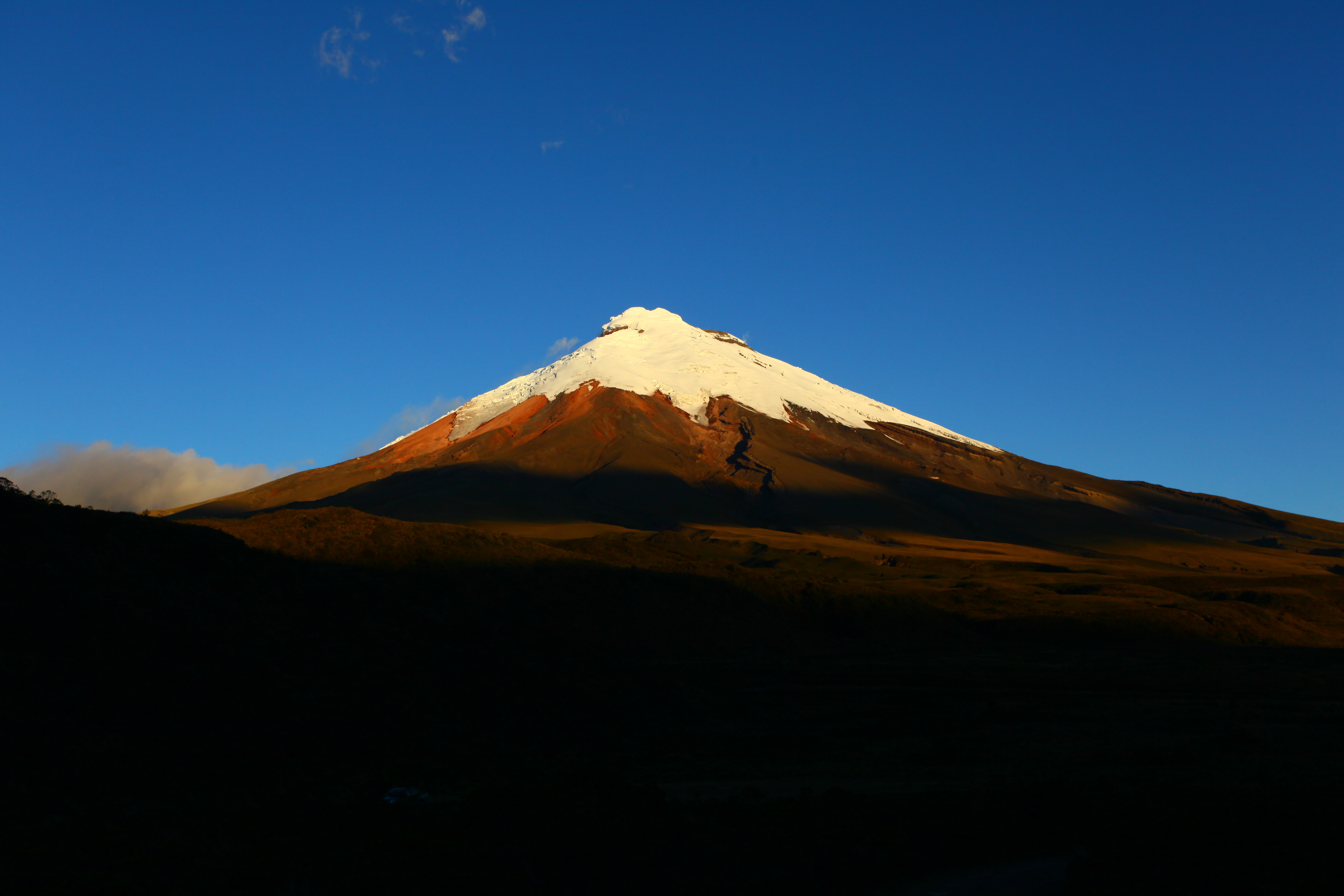 I’m going to cut it off here and put Cotopaxi in a separate post as I am trying to keep this one mostly to the Ruta del Condor and the approach. If you decide you want to give it a go, again which I find hard to recommend, please let us know if you have any questions. I think the trek has great potential, both for pleasure and pain. I read other blogs thinking, “pff amateurs” but now I know better. Don’t hesitate to get in touch or point out any omissions.

Brent,
As always, I am overwhelmed at how determined you and Holly, (and Sam) were on this trek. Not sure what you three will be doing in ten years, but feel confident, you will all succeed at what ever you do.
With the descriptions and amazingly clear pictures, I would imagine a book will be in the making at the very least. I read this right before going to bed, and even though it’s still about 85 outside (at 12:10am) and high humidity fogging the windows, I am ready to get under a warm blanket. The wind, fog and damp, chilly weather you described, makes your 60 year old auntie feel a bit chilled. (I could have sworn I saw some stars twinkling in that picture.) I cannot wait for the next installment, now that you have met up with your guides.
Can’t wait to see you and Holly when you get back. Joe is looking forward to more of that wonderful chicken stock you made for Matt at Christmas.
Love ya!
I just tried this. And my first day was like an exact copy of yours. I was navigating by gps as it was so cloudy that nothing was visible. At times the trail from th gps existed, but barely as it was overgrowing by the minute. I decided to call it quits as I woke up because doing this trail in my planned 3 days was nothing but a nightmare.
Hey Niclas,
Sorry you had a similar experience, but please know that it will be one to remember. 5 years down the road, Holly and I still look back and laugh about this whole thing and are happy at least some people find this blog and can relate.
Best,
Brent